Drone Mapping and 3D Models
Drones are a cost-effective solution for precision maps and 3D models of commercial real estate, land and other assets.
 Welcome to Greater Boston Drones, your premier destination for state-of-the-art RTK drone mapping services. As your local mapping expert, we’re dedicated to delivering swift and precise solutions and the deliverables you need. Drones offer a flexible and cost-effective solution, reaching areas that were previously inaccessible without breaking the bank on manned aircraft. We answer our phones, return calls and provide excellent service to our clients.
Our comprehensive suite of services, including drone data capture and deliverable processing, ensures accurate and actionable data for construction progress management, site planning, and real estate development. Drones improve construction site safety by easily revealing safety hazards and OSHA issues from a bird’s eye view. We collaborate with licensed land surveyors helping them to add RTK drone surveying capabilities to their list of surveying services throughout the vibrant New England region.
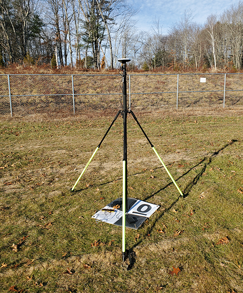
Experience the advantage of our survey-quality DJI RTK drones, with centimeter level accuracy. These drones, combined with our experienced FAA Part 107 licensed pilots and state of the art multi-channel Emlid GPS base stations and rovers and ground control points provide a seamless integration of highly accurate maps and models, catering to a range of applications. Property owners, architects, engineers, developers, and investors can leverage the cost-effectiveness of drone technology for capturing images, gaining valuable insights into property changes over time.
We offer a live streaming option for your data collection activity allowing you to “come along for the flight” from the comfort of your desktop, with live streaming to multiple locations via the Web. Our DJI Enterprise Drones have the ability to load images to the cloud in real time, giving clients the powerful ability to participate from anywhere in the world, reviewing images as they are taken. Choose us for unmatched mapping expertise, seamless collaboration with licensed land surveyors, and a forward-looking approach to your aerial data needs. Let’s elevate your projects with Greater Boston Drones—where precision meets innovation.


